
Needs Assessment
 The Needs Assessment Report identifies the wastewater, stormwater and other nitrogen problems within the Project Planning Area (PPA). The Report evaluates existing conditions such as wastewater treatment facilities (WWTFs), physical land features and land uses, and regulatory issues affecting wastewater facilities. Future conditions are also assessed, such as population and growth and the potential effects on proposed wastewater collection, treatment and disposal facilities.
Wastewater Flows and Nitrogen Loading
Wastewater flows and nitrogen loading (or the amount of nitrogen present in the water) were developed based on MEP reports for the PPA and updated with revised build-out information. Total existing flows for the PPA, including areas in other communities, are 1.6 million gallons per day (MGD). Total future flows are estimated at 2.7 MGD. Residential properties will contribute almost 90 percent of wastewater flows, and wastewater will contribute as much as 80 percent of controllable nitrogen in the future.
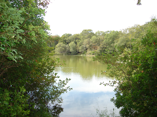
Santuit Pond
Priority Areas
The Needs Assessment then evaluated the PPA based on previously established planning zones in Mashpee (developed by the Town) and some broader areas for the adjacent towns. Each of these were then grouped into larger geographic areas and compared to various criteria to begin the steps of prioritizing nitrogen removal needs.
The assessment looked at the following criteria:
- Was a nitrogen removal percentage assigned by MEP?
- Was the area identified as having high nitrogen loading per acre?
- Was the area identified as being year-round or seasonal (which will come into play for implementation purposes)?
- Were there other non-nitrogen considerations (i.e. Santuit Pond phosphorus, etc.)?
- Was the area located within a Zone II (a water supply protection area established by the state)?
Areas with MEP removal rates, high nitrogen loading and a greater number of year-round residents were weighted the highest for this analysis. “Primary Priority Areas” included the first three criteria, and possibly others as well. “Secondary Priority Areas” had either one or two of the higher weighted criteria.
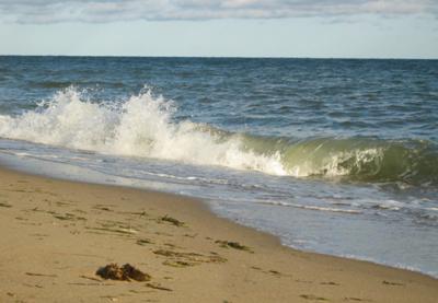
Popponesset Bay
“Tertiary Priority Areas” typically only include one of the top three criteria and at most only two of the five criteria identified above (with the exception of Barnstable's portion of Shoestring Bay). The majority met the year-round and/or Zone II criteria only; therefore, they are more likely to be dealt with in later phases of a recommended plan. These areas also often included one or more of the following types of characteristics:
- low nitrogen loading per acre
- upstream location in the watershed to take advantage of attenuation (or natural nitrogen reduction)
- large areas of open space
- highly seasonal populations
- located near existing WWTFs
- outside of sensitive watersheds
Click here to view the Priority Area Map
Please see the Project Documents Page for the full Needs Assessment Report.